Search
Close this search box.
Research and teaching centre
environmental geosciences
Research and teaching centre
environmental geosciences
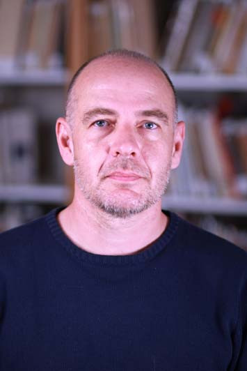
Fleury Jules
Fleury Jules
PAR - Research Support Staff

TP-Earth and Planets

Personal websites
Contact details
Email. : fleury@cerege.fr
Tel: +33 (0)4 13 94 92 03

Responsible of SIGéo (Imagery and Geomatics lab-platform)

I'm a research engineer in geomatics and remote sensing. My activities concern producing high resolution imagery and topography, 3D datasets (Point clouds, DEMs, DOMs), temporal series, and to analyze their input to the study of earth surfaces processes, such as in the fields of geomorphology, tectonics, geology, archeometry, paleo-environment, past-climate markers. Time scales vary from rapid to wide range (seasonal to 106 years).

I imagine protocols and devices to acquire spatial datasets, develop processing workflows, and use dedicated measure algorithms of surface metrics (spectral analysis; change detection; roughness; edge detection; displacement; volume; geomorphologic identification ...).

I teach from graduate to doctoral students, and I use drone equipment and 3D models renderings to show school child and public the use of technology to help decipher earth processes.

Links : technical blog ; drone videos

  • 2006-today - Responsible of the SIGéo (Imagery and Geomatics) platform - CEREGE - AMU, CNRS, INRAE
  • 2004-2006 - Contractual Engineer - Development of a 3D GIS on the geological markers of the Messinian salinity crisis and implications for regional geodynamics: Rhône/Durance region. CEREGE-CEA project - CEREGE - AMU
  • 2002-2003 - Contract researcher. Specification and elaboration of a 3D geological database from Pleistocene to Holocene on the Rhône delta. European project Eurodelta. - CEREGE - AMU
  • 2000-2001 - Consultant. Development of drought indicators by remote sensing and GIS in Madagascar - NGO CARE Madagascar
  • 1999-2000 - Project Manager & Trainer. Design, production, consulting and monitoring of environmental studies using GIS and remote sensing. - CFSIGE - Madagascar
  • 1996-1998 - Geophysical Engineer, Specialist in Remote Sensing-GIS-Natural Hazards. - Geosciences Consultants - Paris
  • 2001 - Specialised Master in Information Systems Architecture - Ecole Nationale des Sciences Géographiques (ENSG) - Champs-sur-Marne
  • 1996 - DEA in "Quantitative Modelling of Sedimentary Basins" - ENSPM, Paris6, Paris7, Ecoles des Mines de Paris - Paris
  • 1995 - M.Sc. Physics - University of East Anglia (Norwich, England), Université Montpellier II - Erasmus exchange
  • Geomatics (GIS and connex topics), remote sensing
  • 3D Surface Modelisation
  • GNSS, topographic and bathymetric surveying
  • Drone mapping
  • LiDAR
  • Photogrammetry

NRA TopoExtreme

NRA EQTime

NRA Quartz

NRA Shormosat

CNES Hilltop

CNES Kyrgyzstan

CNES Geoimpact

OHM Rhône Valley - Bras-de-Fer

ECCOREV - Climed